Pin Fast.
Organize Later.
One-tap GPS field logging for the outdoors. Mark anything instantly, then map, customize, and export later.

The problem
Big mapping apps are built for the kitchen table.
The field doesn't wait.
You found a fresh scrape — or the perfect campsite — in the dark. Do you really want to fumble through six menus, type a label, pick an icon and assign a folder while the moment slips away?
The old way
- Open app
- Find new waypoint
- Pick icon
- Type label
- Choose folder
- Save
The OUTMARK way
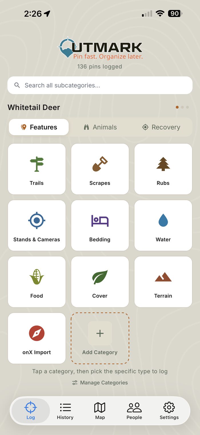
- Tap your category
- Done.
Core features
Everything you need in the woods.
Nothing you don't.
One-Tap GPS Capture
Drop a precise pin in under a second — no typing, no menus.
Custom Dashboards & Categories
Build a layout for any pursuit — your categories and subcategories.
Weather Logged Per Pin
Temp, wind, pressure and moon phase saved automatically.
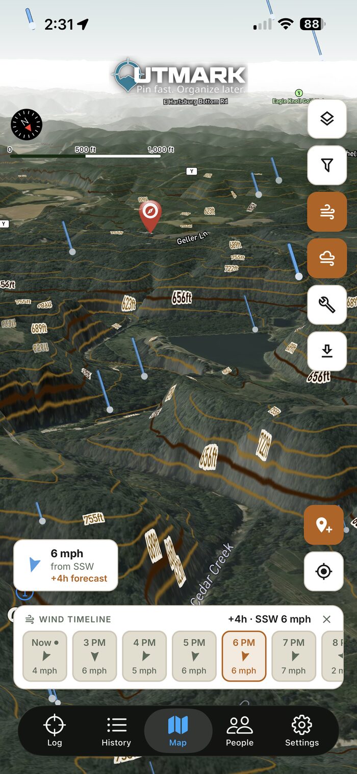
Satellite, Topo & 3D Maps
Switch layers, tilt into 3D terrain, and scout offline.
Wind & Stand Planning
See wind suitability and an hourly wind timeline before you go.
GPX & KML Export + Import
Import pins from GPX or KML files — and export your pins as GPX or KML.
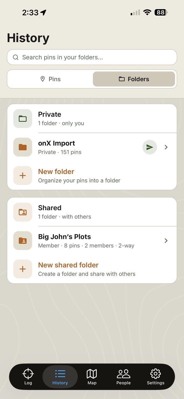
Sharing & Shared Folders
Send pins to your crew and build two-way shared folders.
Cloud Backup & Multi-Device
Your pins sync to your account and survive reinstalls.
How it works
Three steps. Zero fumbling.
Tap a category
Open OUTMARK and tap what you found — scrape, stand, trailhead, shed. One tap.
GPS pin saved with weather
Location, time, temp, wind direction and pressure logged automatically.
Map, organize & export
Review pins on satellite or 3D terrain, sort them into dashboards, and export as GPX or KML.
OUTMARK vs. the rest
Built for the field, not the office.
| Capability | OUTMARK | Generic mapping apps |
|---|---|---|
| One-tap pin in under a second | ||
| Custom dashboards, categories & subcategories | ||
| Weather auto-logged with every pin | ||
| Wind suitability + hourly wind timeline | ||
| GPX & KML export + import | ||
| Pin sharing & two-way shared folders |
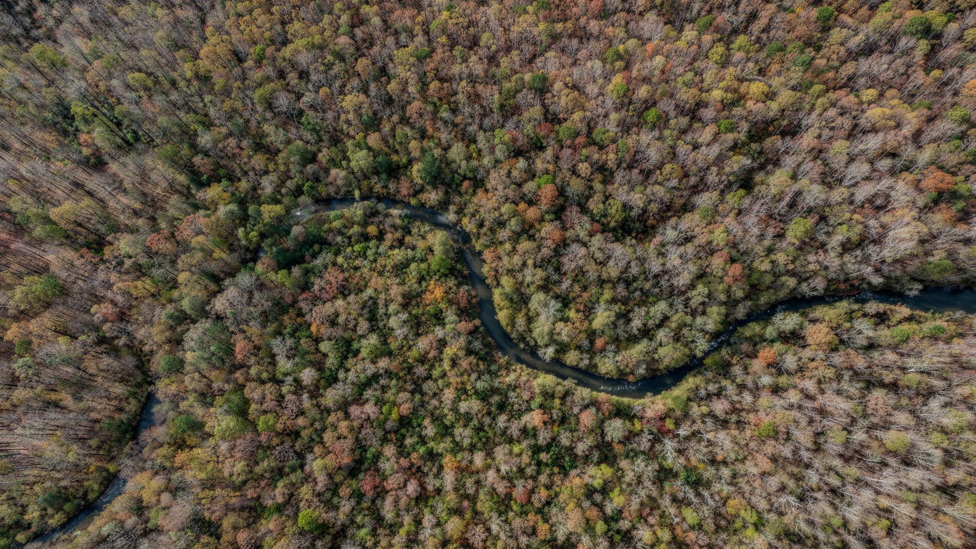
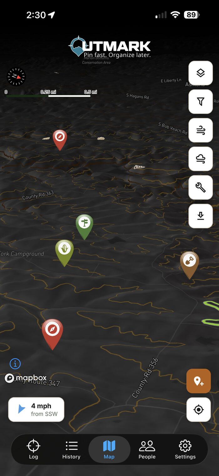
Your ground, mapped
Every mark —on one satellite view.
Layer pins, routes, wind timelines and weather over high-res satellite, USGS topo, or full 3D terrain. Then export the whole thing as a GPX or KML file.
- Satellite, USGS topo & 3D terrain layers
- Hourly wind timeline for planning
- Filter and organize pins by dashboard
Not just for hunting
Mark anything.Make it yours.
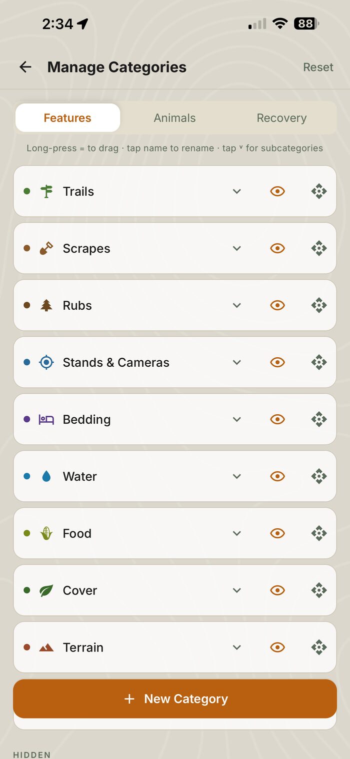
OUTMARK started in the deer woods, but the dashboards are yours to build. Create custom categories and subcategories, swipe between multiple dashboards, and set OUTMARK up for whatever gets you outside — scouting, fishing, shed hunting, hiking, trail work, or managing your land.
- Multiple dashboards — swipe to switch
- Custom categories & subcategories
- Reorder, rename, hide & color-code
- Animal sighting & recovery modes built in
From the field
Trusted in the field.
I dropped 23 pins on opening weekend without breaking stride. Saved me an hour at camp every night.
Finally an app that speaks my language. Scrape, rub, bed, sign — not 'custom waypoint type'.
I built one dashboard for elk scouting and another for marking trail work on our land. Same fast pins, totally different setups.
Pricing
Try free for 14 days.
OUTMARK Monthly
Full access, billed month to month.
- One-tap GPS capture
- Custom dashboards, categories & subcategories
- Satellite, topo & 3D maps
- Weather & wind logged per pin
- GPX & KML export + import
- Pin sharing & shared folders
- Cloud backup & multi-device sync
OUTMARK Yearly
Best valueEverything in Monthly — two months free.
- One-tap GPS capture
- Custom dashboards, categories & subcategories
- Satellite, topo & 3D maps
- Weather & wind logged per pin
- GPX & KML export + import
- Pin sharing & shared folders
- Cloud backup & multi-device sync

Mark your spot.
Download OUTMARK.
Start with a free 14-day trial. Works offline. Built by hunters who got tired of waiting on menus — made for everyone who'd rather be outside.